Why Field Boundaries Bend Around the Land
Why field boundaries bend around the land: read slopes, streams, and cultivation patterns to interpret practical edges while keeping uncertain histories in view.
The common mistake in reading a field boundary is to treat every bend as a property line drawn for its own sake. That can make a landscape seem arbitrary and obscure how a slope, wet hollow, or long-used cultivation pattern shaped the edge. To understand why field boundaries bend around the land, begin with the ground they meet, then consider what work the boundary may have served.
Start with the edge
A field boundary is a feature that marks a change in use or separates one parcel from another: a hedge, bank, ditch, wall, fence, stream, or shift in vegetation. It may be an obstacle, a drainage route, a way to contain livestock, or a line retained from an older arrangement. One edge can serve several purposes at once.
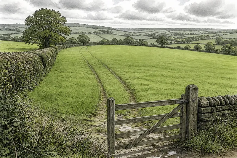
Read the boundary in relation to the land on both sides. Does it follow a contour, cross a slope, turn around a damp patch, or run toward a gateway? Then look beyond it. A neighboring hedge may continue the same line, while an apparently isolated curve may connect with a track, stream, or terrace.
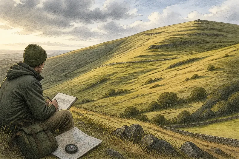
Choose a vantage point where you can see both the boundary and the field’s shape. A map helps, but it flattens the slope; a ground-level view restores the rise, dip, and direction of water.
When slopes shape edges
If a boundary runs across a hillside, check whether it follows a contour: a line at roughly the same elevation. A contour-following edge may be easier to cultivate than one that climbs straight uphill, and it may interrupt the movement of water or soil. The curve can make more sense when you read the field as a working surface rather than a flat shape on a map.
Look for supporting changes in the ground. A bank may be higher on its uphill side, or a shallow hollow may collect water below it. A level strip, terrace-like step, or track running along the slope can offer further clues. These signs are suggestive, not conclusive: a hedge might also follow a contour because of later planting or a boundary adjustment.
If the boundary cuts across the slope, consider whether it divides land with different uses or links fixed points, such as a lane and a stream. A straight line does not prove recent planning, just as a curved one does not prove great age. Terrain can help explain shape, but it cannot date a boundary by itself.
On a hillside, compare the line with the slope before assigning a purpose to its curve.
When water redirects a line
Streams, springs, and seasonally wet hollows often influence where a field can be worked or crossed. A boundary may bend away from wet ground, follow a streambank, or meet a crossing where the ground is firm. In a low-lying field, a ditch can mark the edge while carrying water away; its route may look crooked because it follows the land’s fall.
Look for small changes in vegetation and surface. Rushes, sedges, darker soil, or a narrow band of damp ground may indicate a wetter strip, though plants and soil vary with season and management. A dry-looking channel may still carry water after rain. Observe from a firm path rather than stepping into a ditch or onto a soft bank.
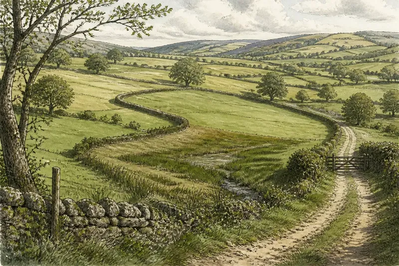
Imagine a field edge that curves around a shallow, rushy hollow before meeting a farm track. A narrow channel continues from the hollow toward a nearby stream, and the ground rises on either side. In this invented situation, the observer notes those features and follows the channel’s direction from the path; the resulting reading is that the curve may keep cultivation away from wet ground while preserving a route to the track. The visible clues support that possibility, but do not establish who made the boundary or why.
When water seems influential, trace the drainage direction as well as the visible stream.
When older cultivation remains
Some boundaries preserve outlines from earlier ways of dividing and working land. A hedge may mark an old strip or enclosure, while long, narrow parcels can suggest division into working strips. Curved edges may reflect plowing routes or the way an older boundary met a slope. Such patterns offer clues, not a complete history.
Check whether the line has neighbors in the wider landscape. Repeated parallel boundaries, slight ridges, or adjoining curves may indicate an organized pattern rather than a single practical detour. A lone bend is harder to interpret. Compare it with nearby edges, paths, and field shapes, and note whether the same orientation recurs.
Boundaries can persist after the activity that formed them has changed. A hedge may remain after a field is enlarged, or a ditch may retain its route when its original role is less visible. Present use does not necessarily explain a boundary’s first purpose.
How should clues be weighed?
Does the boundary follow a contour?
Favor a slope-related reading if the line stays at a similar height and the land above or below changes in steepness. A bank, terrace, or track along the same level strengthens that possibility, though none establishes the boundary’s age.
Does the curve enclose wet ground?
Favor a water-related reading if the curve surrounds a hollow, spring line, or stream margin and damp vegetation follows the same route. Check where water would drain after rain, since a ditch may be hard to see in dry weather.
Do nearby fields repeat the shape?
Favor an inherited cultivation pattern if several boundaries share an orientation, curve, or strip-like form. Repetition is more informative than a single unusual edge, but later changes may preserve, divide, or blur an older layout.
What if clues support two readings?
Allow for more than one purpose, such as a hedge that separates parcels while following a contour above wet ground. Record visible clues separately from explanations, and leave the origin uncertain if the evidence cannot distinguish between possibilities.
Separate clues from claims
A useful field note distinguishes what can be seen from what is inferred. “Hedge bends around a hollow; rushes grow inside the curve” describes observations. “The hedge was planted to protect crops from flooding” proposes a cause and past intention that the visible scene may not establish.
For a careful reading, check each feature and let its result guide the next decision:
- Line: Check whether the edge is straight, curved, stepped, or broken; if a bend follows a visible landform, compare that feature with the edge, and if it does not, leave the curve unexplained for now.
- Relief: Check whether the boundary follows a contour, crosses a slope, or circles a hollow; if it stays near one level, consider a slope-related reading, and if it climbs or drops, compare the line with fixed features such as a lane or stream.
- Water: Check for streams, ditches, springs, and damp vegetation; if they align with the bend, consider a water-related influence, and if they do not, avoid treating wet ground as the cause.
- Connections: Check where the edge meets tracks, gates, roads, and neighboring boundaries; if it links two clear features, consider whether that connection explains its direction, and if it ends without an evident link, keep the purpose open.
- Repetition: Check whether nearby fields share the boundary’s direction or shape; if several lines repeat it, consider an inherited pattern, and if the form is isolated, give more weight to local terrain and use.
- Competing clues: Check whether slope, water, and repeated field shapes point to different explanations; if they overlap, record multiple possible influences, and if none is supported by the visible setting, describe the shape without assigning a cause.
These notes make comparisons easier without turning a plausible explanation into a fact. If the distinction matters for ownership, access, or land management, consult appropriate maps and seek advice from a qualified professional rather than relying on appearance alone.
Let the land qualify the answer
When reading why field boundaries bend around the land, match each explanation to its strongest visible setting: a contour for slope, a hollow or channel for water, and repeated shapes for older cultivation. If two settings overlap, keep both in view. The most useful interpretation accounts for the boundary’s position and connections without claiming more than the landscape shows.
On your next walk, compare a curved edge with a straighter boundary nearby. That contrast may reveal which features of the ground each line accommodates, even when the full history remains unknown.